Fload and coastal protection

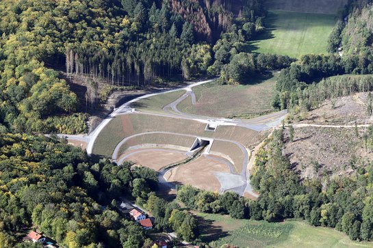
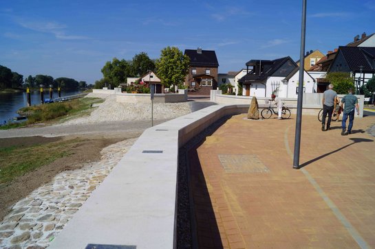
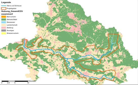
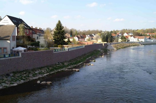
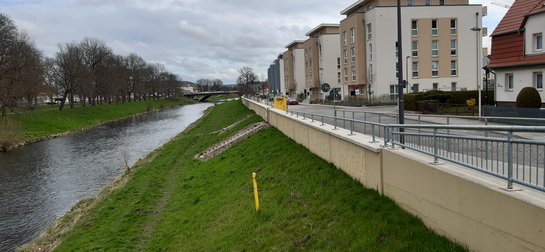
We are experienced in flood and coastal protection in all major river basins as well as on the North Sea and Baltic coasts. We develop and supervise projects in the open countryside as well as in built-up areas and city centres, from conception and approval through to construction. All the specialist disciplines required to offer a one-stop solution as a general planner are available.

Expertise:

  • Flood retention areas
  • River engineering
  • Coastal protection
  • Dykes
  • Protective structures / barrages
  • Hydraulics
  • Hydrology
  • Groundwater
Flood retention basin Neuwürschnitz

The Neuwürschnitz flood retention basin (HRB) in the Beuthenbach catchment area is located southwest of Chemnitz on the A72 motorway. The dam was built as a rockfill dam with an asphalt concrete inner seal. The total storage capacity is approx. 1,029,000 m³. The dam crest is 16.70 metres above the foundation base. The necessary underground sealing was carried out using the injection method. The…

Read more

Storm surge protection Borkum

The flood defence wall runs along Reedestraße and forms a self-contained system with the "black dyke". The flood defence system extends over three areas: the private area, the German Youth Hostel Borkum and the SAR Borkum naval airfield. The main objective of the repair measure was to restore or repair the necessary technical flood protection.

Client: Staatliches Baumanagement Nord-West

Processi…

Read more

Flood retention basin Wippra

The controlled basin is located directly above the spa town of Wippra in the district of Mansfeld-Südharz, protects 21 villages from flooding and is the central component of the flood protection concept (HWSK) for the Wipper. The barrier structure consists of a dam with an ecologically continuous culvert structure in which the operational outlets and spillways are integrated. A quarry in the…

Read more

Flood protection Elster

During the August floods of the Elbe in 2002 and the June floods in 2013, the planning area with the Elster, Iserbegka and Listerfehrda districts was affected by flooding on a large scale. Flooding was caused both by the Elbe, which was in flood, and by backwater from the backwaters such as the Schwarze Elster, the Zugbach and the Wiesenbach.

The work began with a study covering all HOAI service…

Read more

In preparation for the creation of the flood hazard and flood risk maps within the framework of Directive 2007/60/EC of the European Parliament and of the Council of 23 October 2007 on the assessment and management of flood risks (EC FRMD), the flood hazard areas were to be newly determined. Together with Aquasoli, Siegsdorf, Tractebel Hydroprojekt was awarded the contract for two lots. Tractebel…

Read more

Hochwasserschutzkonzept Werra

The Werra and the lock are classified as 1st order watercourses and are therefore under the maintenance responsibility of the Free State of Thuringia. An integral flood protection concept (i-HWSK) is to be drawn up for the above-mentioned watercourse sections. As part of the i-HWSK, deficits in flood protection are identified and named. Based on the deficits identified, optimised solution…

Read more

The municipality of Nüdlingen in the Lower Franconian district of Bad Kissingen has been hit by flash floods several times in recent years. In order to be able to effectively counter this risk in the future, the municipality commissioned Tractebel Hydroprojekt to draw up an integral flash flood risk management concept. This concept includes an analysis of the current situation and past events, the…

Read more

Flood protection Penig

The flood protection concept for the Zwickauer Mulde planned by Tractebel Hydroprojekt (formerly Lahmeyer Hydroprojekt) included protection measures for a 100-year flood for the town of Penig. The route was divided into separate lines in the HWSK: A, B, C1 and D. The section B planned by us runs parallel to Lunzenauer Straße and consists of two types of construction.

Client:

Read more

Flood protection Gera

The Thuringian State Office for the Environment, Mining and Nature Conservation (TLUBN, formerly TLUG) has implemented flood protection measures (HWS) on the left bank of the Weiße Elster in the city of Gera. In the Untermhaus district, an HWS wall was erected on Faulenzerweg as an angled retaining wall. Underpinning and support work on the listed buildings of the Hofgut was necessary for its…

Read more

Polder Außig

The site of the planned flooding polder is located to the left of the Elbe and to the right of the Dahle (1st order watercourse) in the district of North Saxony in the Free State of Saxony near the village of Außig. An area of 360 hectares is intended to be used for the construction of the polder. The aim of the polder is the effective peak capping of flood events greater than HQ100 of the Elbe.…

Read more